Wheathampstead Heritage: Virtual Museum Exhibit

River Lea
Natural
Not applicable
main image for this site
Chalk stream that was once part of the boundary between Saxon England and Danelaw.

Main Description: Click to expand/contract

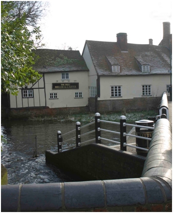
The Lea at this point is shallow, fast flowing and high in nutrients. It flows 42 miles from Luton through Hertfordshire and north-east London, where it becomes the Lee Navigation, and discharges into the Thames at Bow Creek.

The river may derive its name from the Celtic 'lug' meaning 'bright'. The Irish or Gaelic spelling is 'lugh', hence Lughton, now Luton, where the Lea rises. Both the river and the town may have been named after Lugh the Shining One, the Celtic god of light and of the harvest. It is said that he drank from the source of the river and gave it its name.

Following a treaty between King Alfred the Great and Guthrum the Old in 886, the river formed part of the boundary between Saxon England (to the south of where you are standing) and the Danelaw (to the north).

The current road-bridge was first built in or before 1867, widened in 1895 and rebuilt in 1986.

At the north end of the bridge stands the village sign. This was erected in 2010 as part of the celebrations to mark the 950th anniversary of the deed by which Edward the Confessor granted Wheathampstead to the Abbey of Westminster.

The river is well stocked with fish, including barbel, roach and carp. You may be lucky enough to see a kingfisher or a grey wagtail, as well as the more common mallards.


In-depth Description: Click to expand/contract

Additional Files: Click to expand/contract

There are currently no additional files associated with this site

Lea, Mill,

Lea: Cherry Tree Lane  Cherry Trees Restaurant  Lea Valley Walk  Leasey Bridge  Leasey Bridge Lane  Marford Cottage  The Bull Inn  The Mill  

: Ayot Green station  Ayot Greenway  Ayot St Lawrence  Beech Hyde Farm  Brass Ewer  Bride Hall  Bridleway   Bridleway Ayot St Lawrence  Brocket Arms  Brocket Hall  Bury Farm  Bury Farm Cottages  Cassivellaunus  Castle Farm  Castle Rise  Chalk Dell  Cherry Tree Lane  Cherry Trees Restaurant  Coleman Green Holloway  Coleman Green Lane  Collins Corner  Cromer Hyde  Cromer Hyde Lane, No. 12  Cromer Hyde Lane, No. 14  Cromer Hyde Lane, Nos. 16-18  Cromwell Piggeries  Crooked Chimney PH  Cross Keys PH  Dell, The  Devil’s Dyke  Dolphins  Elephant and Castle  Field boundaries  Flint Bridge  Folly, The  Footpath to Ayot St Lawrence  Four Limes  George Upton Robins  Hill House  John Bunyan PH  John Bunyan’s Chimney  Lamer estate  Lamer House  Lamer Lane  Lamer Wood  Laurels, The  Lea Valley Walk  Leasey Bridge  Leasey Bridge Lane  Level Crossing and Cottage  Local Nature Reserve  Lord Cavan  Mackerye End  Marford Cottage  Marford Road  Marford Road, No. 133  Marshalls Heath  Melissa Field  Mid Herts Golf Club  Necton Road  Nomansland Common  Nomansland Common Puddingstone  Nomansland Farmhouse  Old Beech Hyde  Robinson’s Wood  Roman road north  Rose Lane  Sarah Jennings  Shaw’s Corner  Sheepcote Lane  Slad, The  Sparrowhall Bridge  St Lawrence Church  St Lawrence Church (ruined)  St Peter’s Church  Stocking Springs  The Bull Inn  The Forge  The Hill  The Hill, Nos. 76A & 76B  The Meads  The Mill  The Old Church School  The Two Brewers  The Waggoners’ Pub/Restaurant  The White Cottage  Tin Pot, The  Town Farm  Turners Hall Farm  Upper Cromer Hyde Farmhouse  Walnut Tree, The  Waterend House  West End Farm  Wheathampstead House  Wheathampstead Place  Wheathampstead Station  Wicked Lady PH, The  Wright’s Nurseries  

Show Map   Hide Map


Date Created: 01/01/2012 01:01:01, by: Adam   Date last edited: 25/02/2014 17:11:52, by: patrick

Close Window